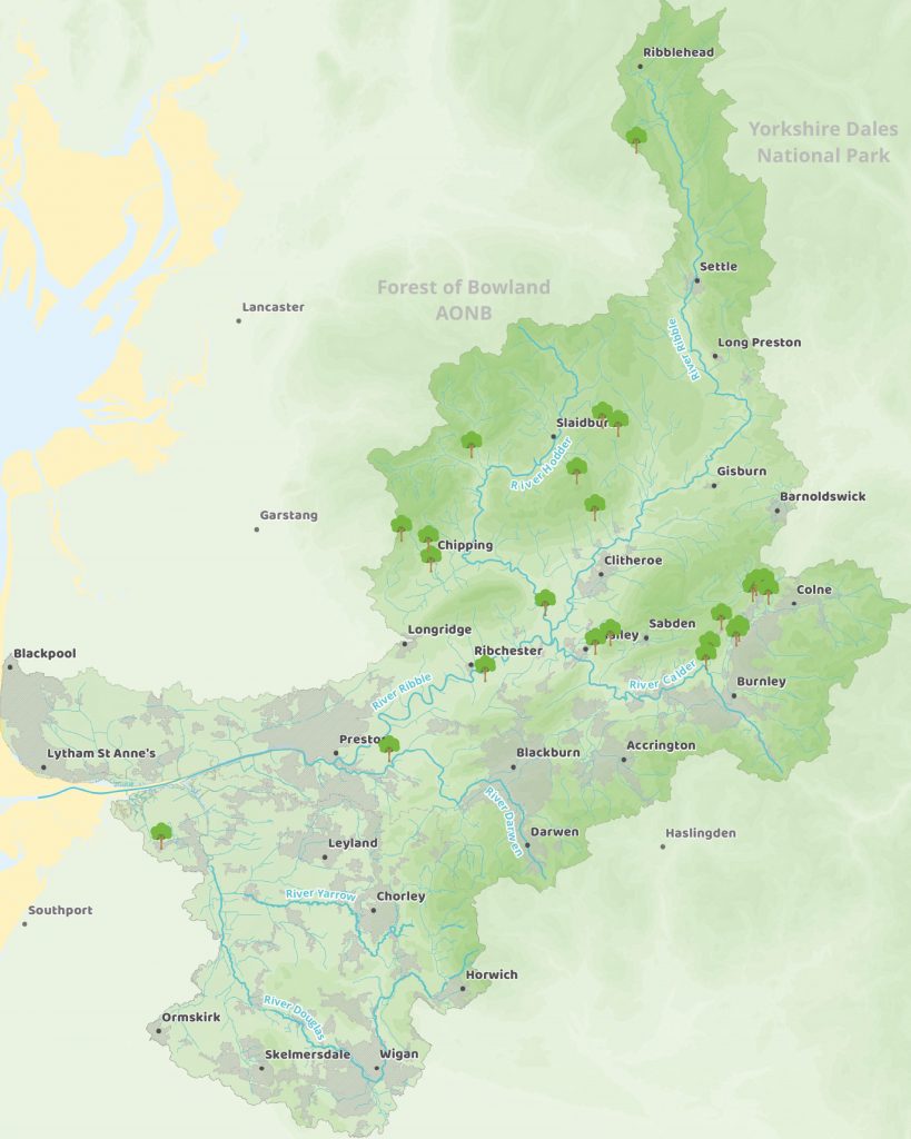
our catchment
the ribble River catchment
The Ribble Rivers Trust was founded over 25 years ago with the aim of protecting and improving rivers for wildlife and people. Whilst this sounds straightforward on paper, it’s a pretty epic task! Whilst the River Ribble itself is one of longest and most diverse rivers in the UK, it also has a significant catchment area.
But you might have wondered what we mean by the Ribble catchment.
What exactly is a river catchment?
A river catchment, also known as a drainage basin, is an area of land from which all water flows into a single river system. It is essentially the geographical area that surrounds a river and all its tributaries, including the land, hills, mountains, and other features that drain into it.
The boundary of a catchment is defined by the highest points, such as ridges and hilltops, that form the watershed, which separates the catchment from other adjacent catchments. When precipitation, such as rain or snow, falls within the boundaries of a catchment, the water is either absorbed into the ground or flows over the surface and into the river system.
The size of a catchment can range from small, such as those that feed into small streams, to very large, like those of major river systems such as the Amazon. The health of a catchment can have a significant impact on the water quality and quantity of the river and its surrounding ecosystem, as well as the communities that rely on it for drinking water, irrigation, and other uses.
Therefore, catchment management is an important aspect of environmental and water resource management. In fact, you could say that rivers are at the heart of almost every ecosystem in the world.
Tell me more about the Ribble catchment
The Ribble river catchment covers an area of over 750 square miles and contains more than 3479 miles (5,600 kilometres) of watercourses. As well as the Ribble we look after the Calder, Hodder, Darwen, and Douglas sub-catchments.
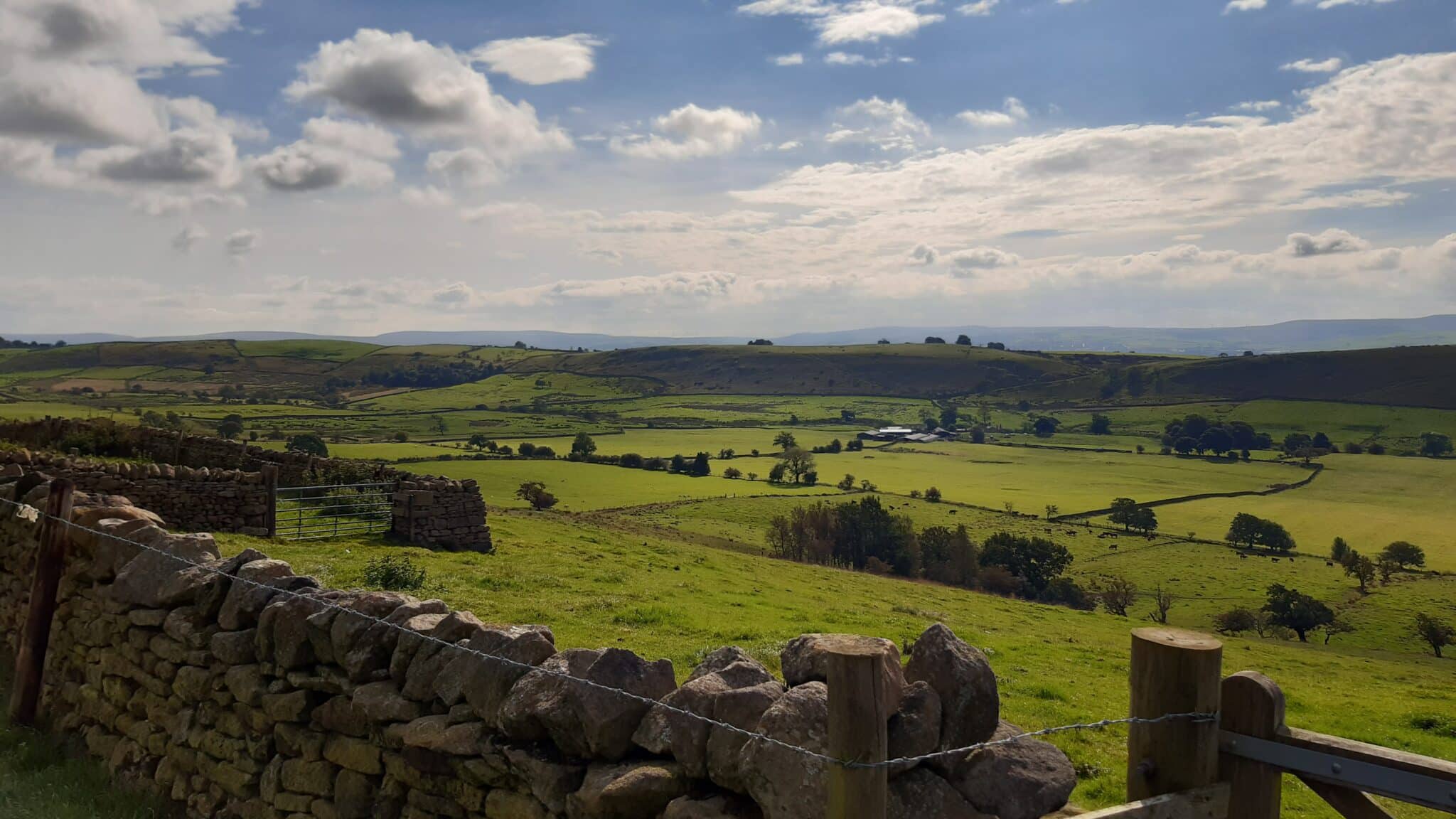
Across this area is a really diverse and varied types of habitats. From farmland, to woodland, to cities and industrial areas. Because of this variety in habitat there is huge variety of fish, mammals and invertebrates that call this area their home.
If you’d like to explore this wonderful landscape then we can help! Our river walks cover 15 areas, and, with a variety of lengths and difficulties, there is a walk for everyone. If you prefer the comfort of your own home, or you like to plan your own adventures, our interactive scenic places map can show you some of the hidden gems in our catchment.
How do you cover such a large area?
Working over 750 square miles of catchment means our projects cover a lot of ground, and our work can really vary from project to project. At any one time we could be working on moorland restoration at Ribblehead, river engineering projects in mill towns like Burnley, and urban woodlands in cities like Preston.
As part of our work, we follow the Catchment Based Approach (CaBA). This focuses on working with other partners across the whole of the Ribble river catchment, linking our work together, sharing knowledge, and teaming up to deliver a wide range of environmental, social, and economic benefits. Although we’re working for rivers, we work on so much more than rivers!
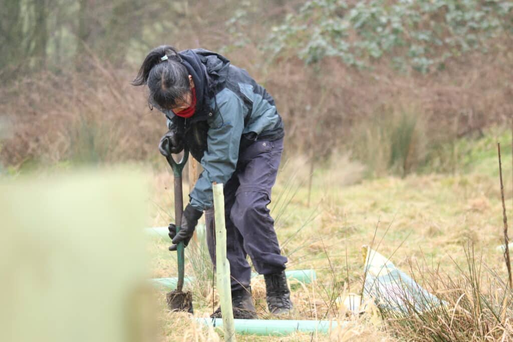
It also helps that we have a wonderful team of volunteers and citizen scientists. They help us with project delivery, data collection, and the general people power we need to help with our work. From tree planting to otter spotting, they help us in so many ways. Our volunteers are true River Heroes!